Are you going to visit Dubai soon? In this short post, you will find some maps and plans of the city which will help you to better situate this emirate and to move more easily during your stay in Dubai.
MAP OF THE MIDDLE EAST
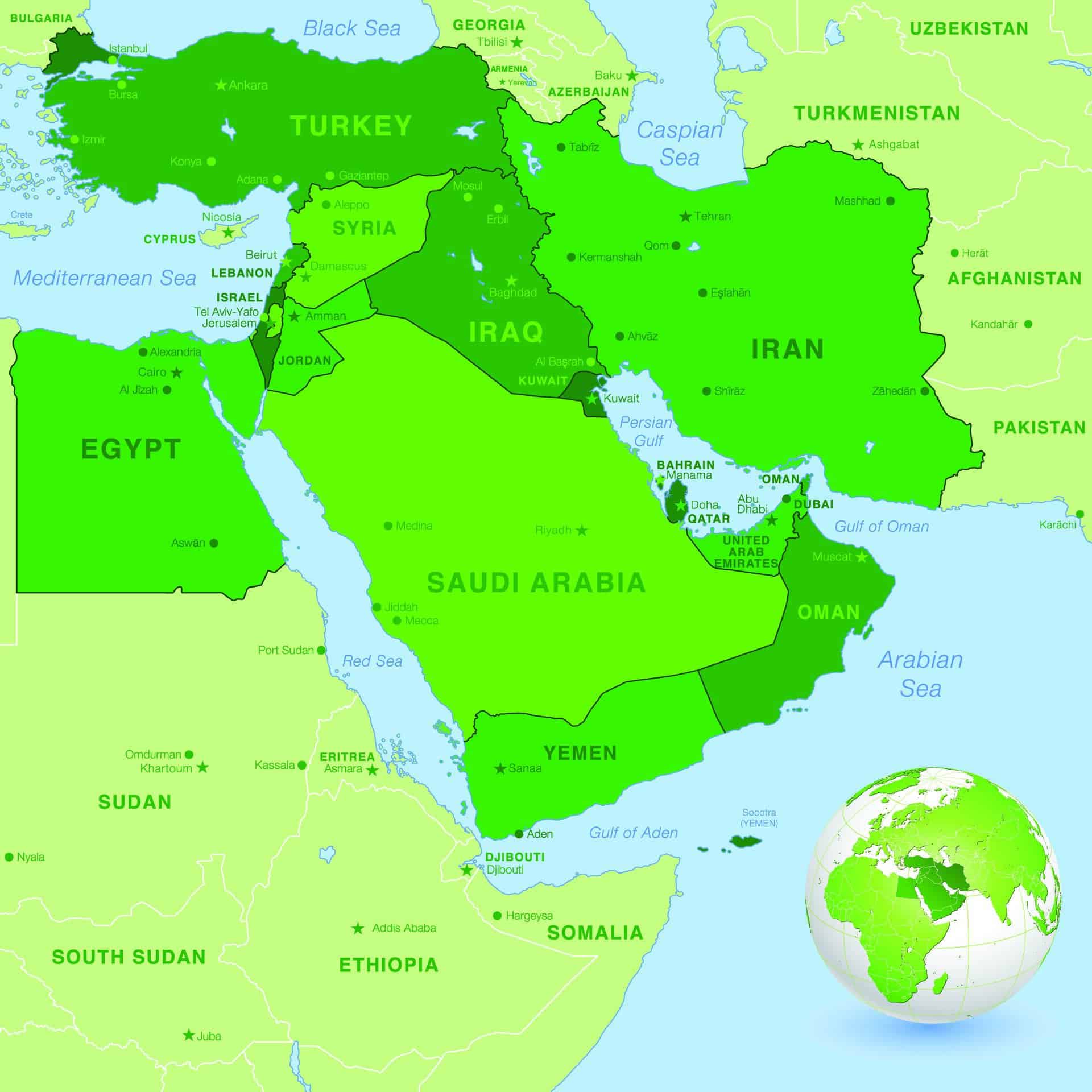
Dubai is part of the United Arab Emirates, which is located in the Middle East. The U.A.E. borders Oman and Saudi Arabia, and is bordered to the north by the waters of the Persian Gulf.
MAP OF THE UNITED ARAB EMIRATES
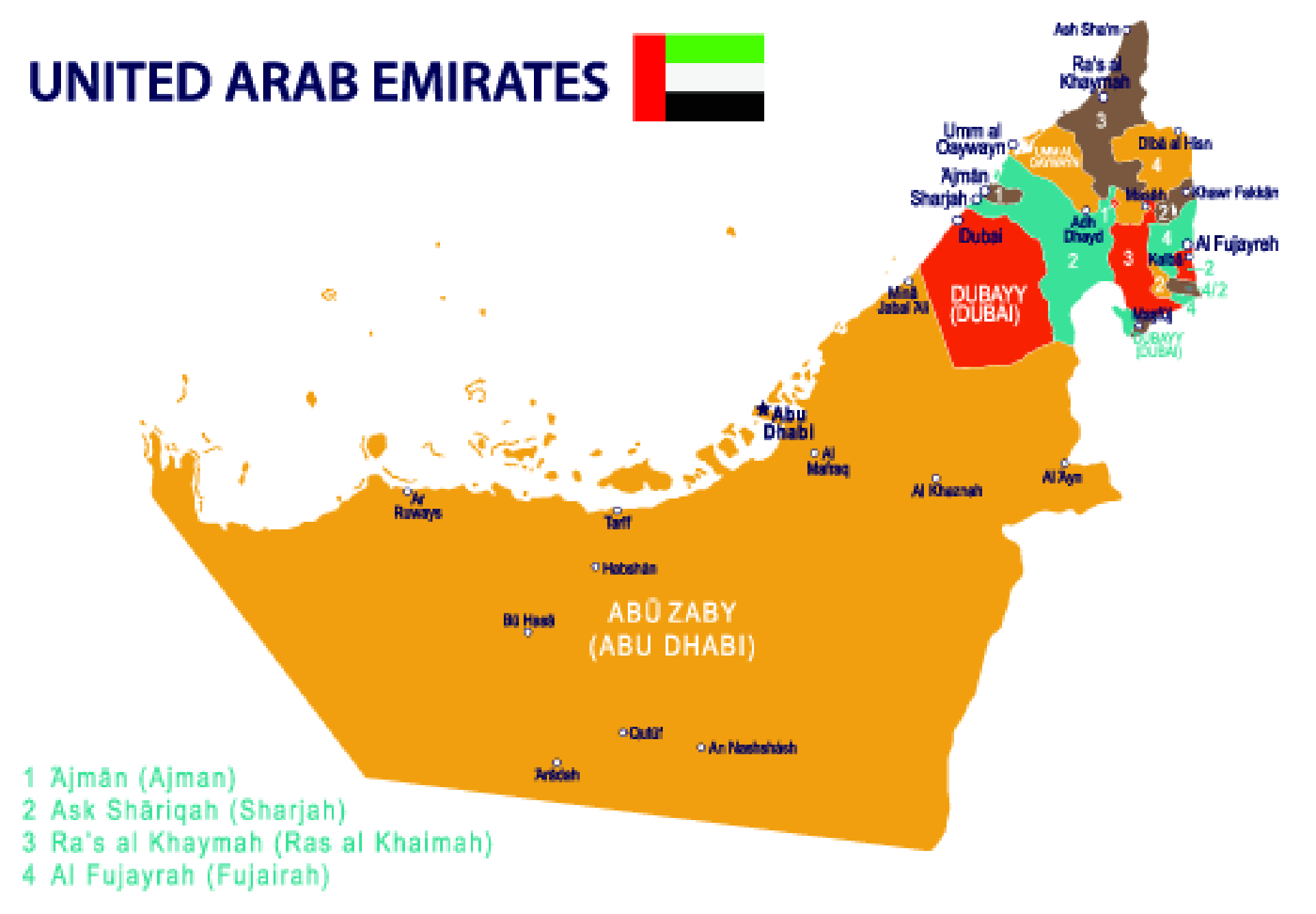
Dubai is located in the heart of the United Arab Emirates, between the emirate ofAbu Dhabi – which is by far the largest – and the Emirate of Sharjah.
THE MAP OF DUBAI
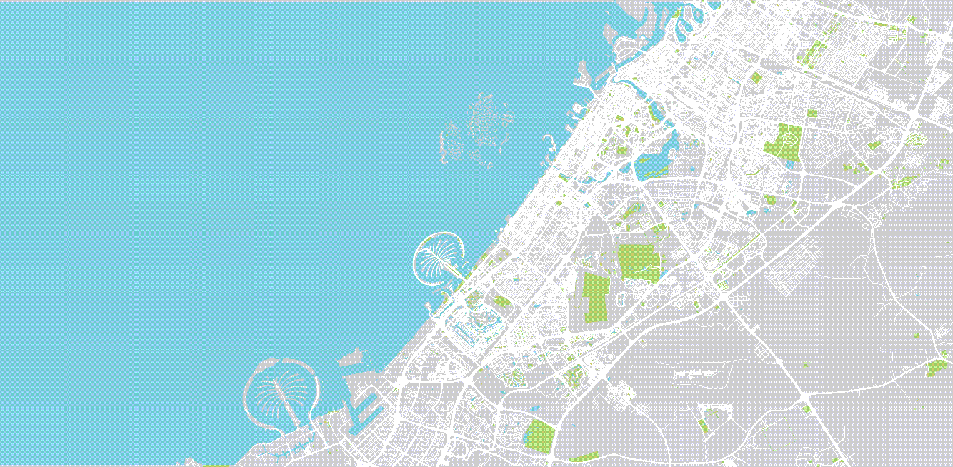
Dubai is a huge city, covering an area of 1,588 sq mi (4,114 km²) and home to over 3.3 million people.
DUBAI'S TOURISM PLAN
With this Dubai city tourism plan, you can easily find the location of the city's main attractions, museums, shopping malls, beaches, souks and hotels.
DUBAI PUBLIC TRANSPORT MAPS & PLANS
In Dubai, you will probably have to use public transportation to reach some of the city’s sites. Sometimes you may even have to start your journey by subway and end it by bus or boat. These maps can help you get around Dubai more easily.
MAPS OF THE DUBAI METRO
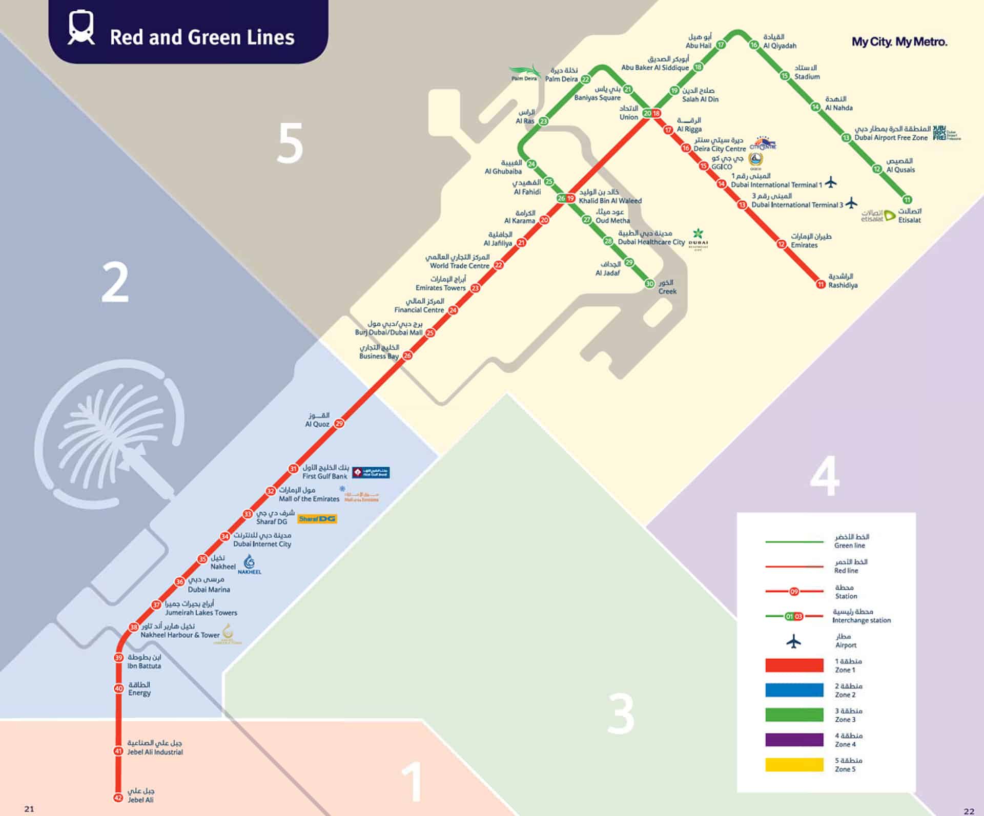
There are two subway lines in the Dubai Metro: the Green Line and the Red Line. The red line runs through almost the entirety of the city, while the green line focuses on the Old Dubai and the most touristy sites.
PLAN OF DUBAI’S STREETCAR NETWORK
The streetcar network in Dubai is made of a single line. It connects the city center to Al Surfouh, a seaside district located between the Mall of the Emirates and Palm Jumeirah.
Click here to access the map 🙂
MAP OF DUBAI’S BUS NETWORK
Since there are only two subway and one streetcar lines in Dubai, if you want to reach certain areas of the city you can save money by traveling by bus (instead of taking a cab). Dubai's bus network is particularly well supplied. You can see the complete bus map by clicking here.
DUBAI FERRY MAPS
The ferry is a good way to discover some of the main sites of Dubai from the sea, in very modern and air-conditioned boats. The ferries cover 6 different routes in Dubai.
3 maps are available:
- The Global Map of the routes around the city
- The targeted map of the routes around the Dubai Marina area
- The targeted map of the routes around the Dubai Creek area
MAPS OF DUBAI'S WATER CABS, ABRAS AND WATER BUSES
Water cabs (or Water Taxis) complement the city's bus network. With more than 40 stations along Dubai's shores, water cabs are a great way to avoid traffic jams and to see Dubai from a whole new perspective.
Abras are traditional small wooden boats of Dubai. You can use them in the Old Dubai to cross the Dubai Creek and go from Deira to Bur Dubai. As such, it's a typical, fast and really cheap way of locomotion (a few cents) 🙂
Water Bus are modern abras that allow you to travel only to make short trips in the Dubai Marina (which is the district in which you can fly over the city, if you want to discover the great zipline of Dubai!) !)
And that's it, this is the end of this article! I hope that the different maps and plans of Dubai given here will help you move more easily in the city 🙂 We often limit the means of transportation to the most well-known ones (bus, subway, ...) but in truth, Dubai has multiple means of transportation that can really facilitate your travels (they can save you time and help you avoid some traffic jams at the same time).
And as a tourist, what's better than getting around in Abra? 😉


0 Comments